ESTE Europe
ESTE EU enables to estimate prediction of the source term (release to the atmosphere), to calculate radiological impacts and to suggest protective measures for inhabitants and in agriculture in case of nuclear or radiological accident in Europe. The system is used by crisis staffs at the governmental level in Czech Republic, Austria and Bulgaria.
ESTE EU system:
- enables to utilize results of real radiological monitoring in the process of source term estimation (=predicted or really observed radioactive release) for any location in Europe;
- in the process of source term evaluation, the system uses especially early warning system data (measurements of dose rates, EURDEP) from the territory of the country and from the territory of the whole Europe;
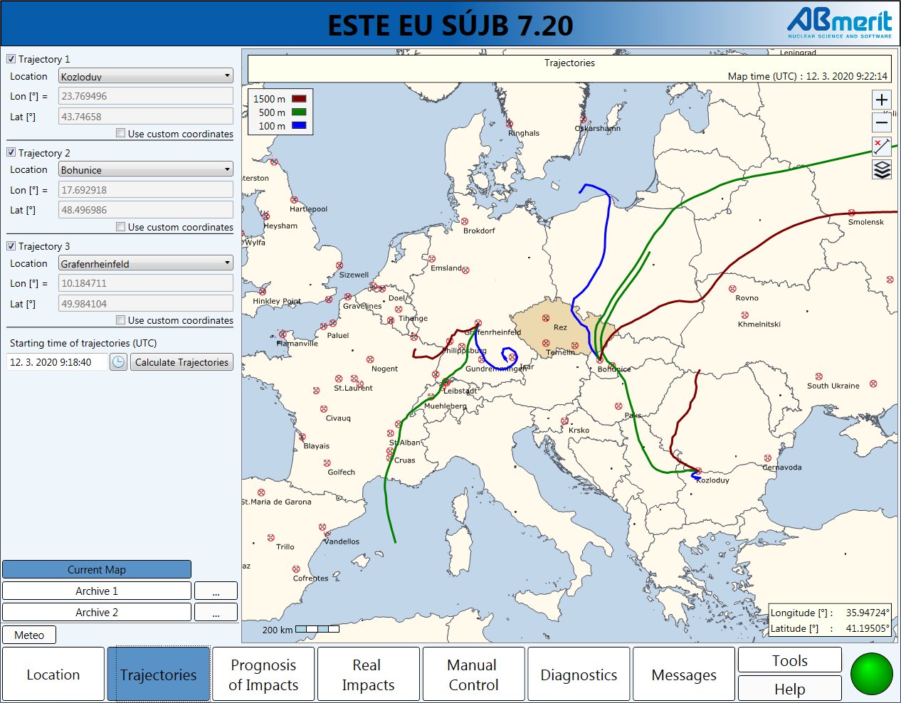
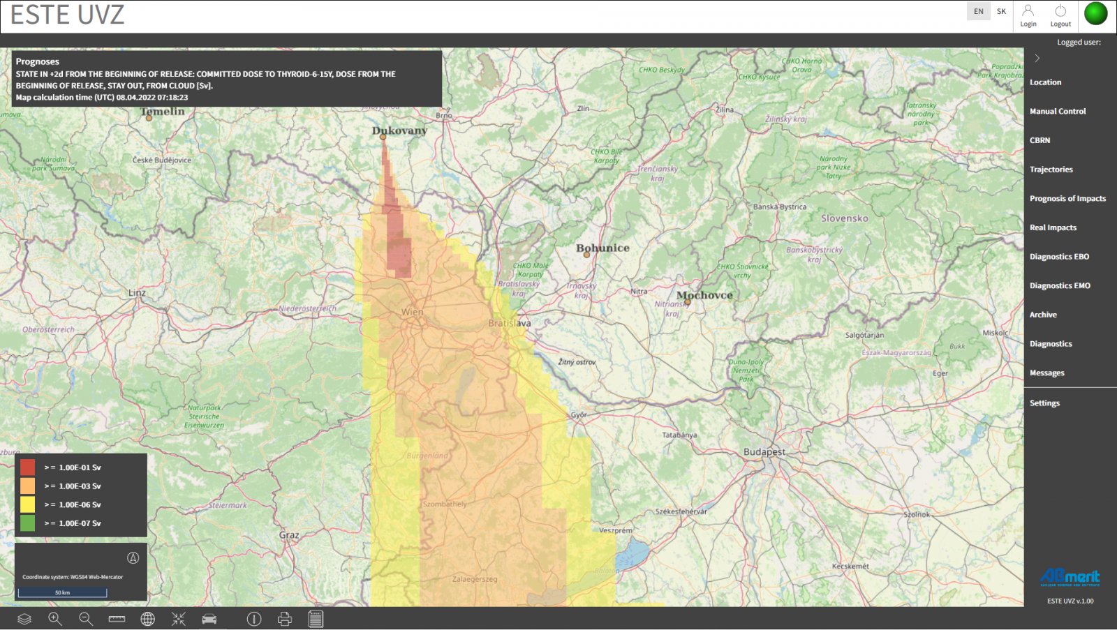
- radiological impacts of release to the atmosphere are modeled and calculated across the Europe and displayed in the geographical information system (GIS) dispersion of radioactive gases and aerosols in the atmosphere is modeled by PTM method (Puff Trajectory Model) and by LPM method (Lagrangean Particle Model);
- the map of modeled real radiological situation (the map of "real impacts"), once calculated, is in regular time intervals compared with real monitoring data and corrected the point of release/the location of accident can be entered manually by the user at any point in Europe (not only at the locations of NPPs or at the location of research reactors, but at any point);
- numerical weather prediction data (NWP in GRIB format) are automatically read by the system dose rates measured in Europe (EURDEP) by early warning systems are automatically read by the system predicted source term or real source term can be generated by the system; ESTE or entered to the system by the user in parallel from many locations on the map, it means that radiological impacts of releases from various places can be modeled by the system at the same time (and can be reported and displayed on the map of impacts as common impacts of all events);
- modeled real radiological situation (the map of "real impacts"), once calculated, is in regular time intervals compared with real monitoring data and method of correction is applied;
- meteorological data and measured dose rates can be entered manually by the user;
- reactor core inventory and assumed spent fuel pool inventory in the database of ESTE is calculated specifically for each European power reactor (by Scale6/Origen);
- the system calculates radiological impacts of the release (predicted or really observed), averted doses according to applied protective measurements, projected doses;
- the system calculates radiological impacts of the release (predicted or really observed) to feedstuffs and foodstuffs.
ESTE EU enables to read and process the outputs of Earth observation remote sensing.